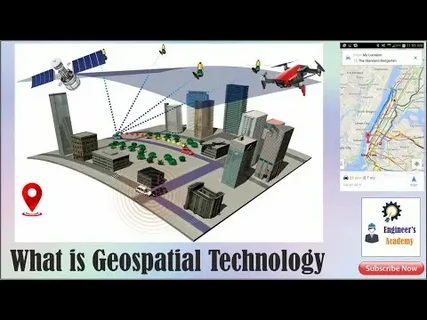
In recent years, technological advancements have drastically transformed various fields of study and practical applications. Among these advancements, the integration of Artificial Intelligence (AI) and geospatial technology has emerged as a groundbreaking development. The integration of AI and geospatial technology in modern research and use is revolutionizing how data is collected, analyzed, and applied across numerous disciplines.
Understanding Geospatial Technology and AI
Geospatial technology involves tools and techniques used to collect, analyze, and visualize geographic data. This includes Geographic Information Systems (GIS), remote sensing, and Global Positioning Systems (GPS). On the other hand, AI refers to computer systems designed to perform tasks that typically require human intelligence, such as pattern recognition, decision-making, and predictive analysis.
The integration of AI and geospatial technology allows researchers and practitioners to harness the power of both fields. AI algorithms can process vast amounts of spatial data, identify trends, and make predictions, which were previously impossible with traditional methods.
Applications in Modern Research
One of the primary areas benefiting from the integration of AI and geospatial technology in modern research and use is environmental monitoring. AI models can analyze satellite imagery to track deforestation, monitor urban growth, and predict natural disasters with unprecedented accuracy. For example, machine learning techniques can detect subtle changes in land use patterns, helping scientists understand environmental impacts in real time.
Another crucial application is in public health. Geospatial data combined with AI enables the mapping of disease outbreaks, allowing health officials to predict the spread of infections and allocate resources efficiently. This integration played a significant role during the COVID-19 pandemic, aiding in contact tracing and hotspot identification.
Enhancing Industry and Urban Planning
Beyond research, the integration of AI and geospatial technology in modern research and use is also transforming industries such as agriculture, transportation, and urban planning. Precision agriculture uses AI-powered geospatial analysis to optimize crop yields, manage resources, and reduce environmental impact.
In urban planning, AI algorithms analyze spatial data to optimize traffic flow, plan infrastructure, and improve public services. This smart city approach leverages geospatial insights to create more efficient and sustainable urban environments.
Challenges and Future Prospects
While the integration of AI and geospatial technology presents vast opportunities, it also faces challenges such as data privacy concerns, the need for high-quality data, and the complexity of integrating diverse datasets. Addressing these challenges requires collaboration among technologists, policymakers, and researchers.
Looking ahead, the future of the integration of AI and geospatial technology in modern research and use looks promising. With continuous advancements in AI, increased satellite coverage, and better data-sharing platforms, this integration will further enhance our ability to solve complex problems and improve decision-making processes.
Conclusion
The integration of AI and geospatial technology in modern research and use marks a significant milestone in technological innovation. By combining the analytical power of AI with the spatial insights of geospatial tools, researchers and practitioners are unlocking new possibilities across various fields. As this integration evolves, it will continue to drive more informed decisions, sustainable development, and innovative solutions worldwide.


